
Regionalization with Dynamically Constrained Agglomerative Clustering and Partitioning (REDCAP)
Introduction
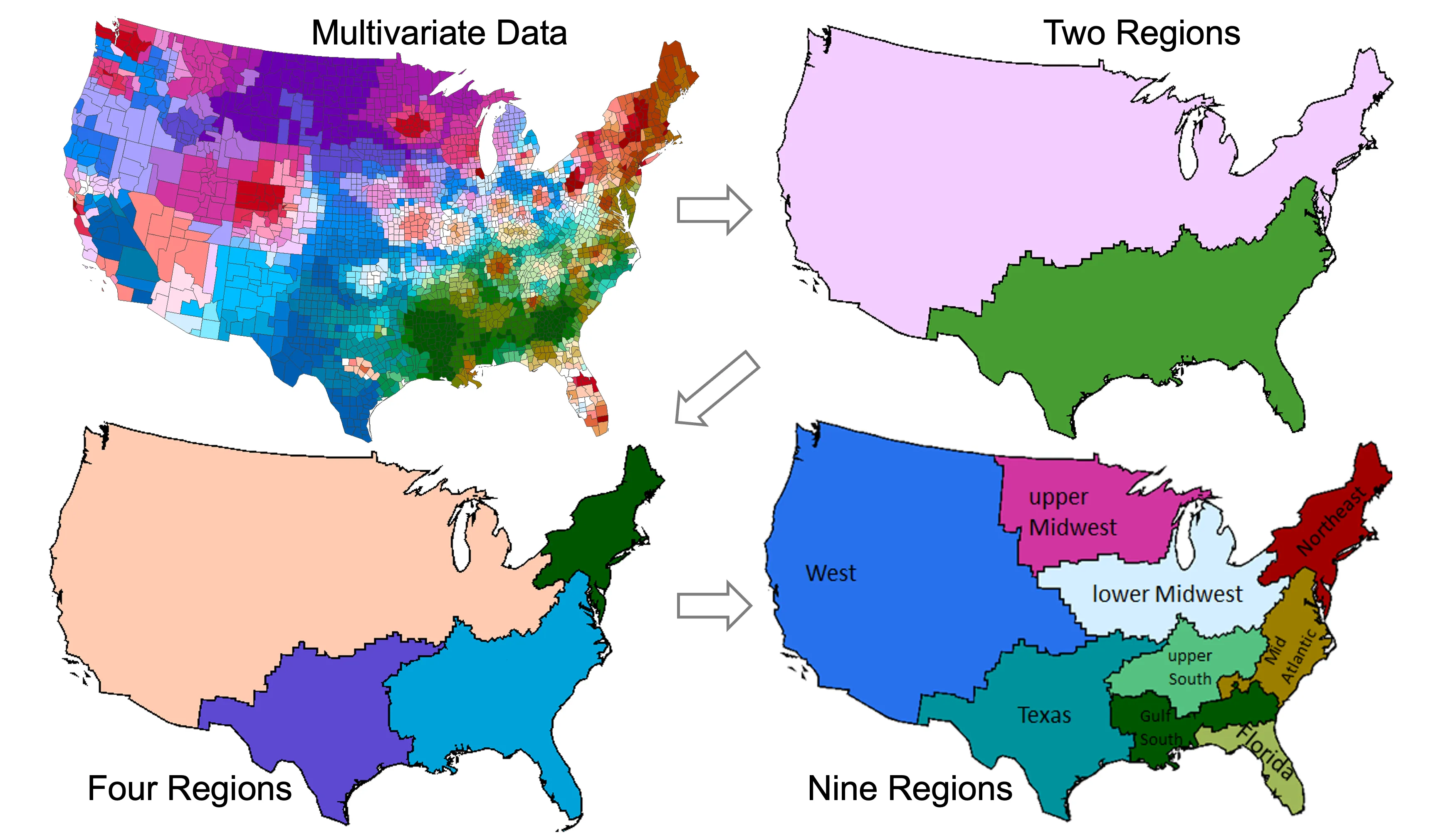
Regionalization divides spatial objects into geographically contiguous regions while optimizing criteria such as within-region similarity. REDCAP is a family of six hierarchical regionalization methods combining three agglomerative clustering approaches—single, average, and complete linkage—with first-order or full-order spatial contiguity constraints. In the original evaluation, full-order complete-linkage and average-linkage methods significantly outperformed existing methods across four measures: total heterogeneity, region size balance, internal variation, and preservation of the data distribution.
Applications of REDCAP span urban and regional planning, public health, ecology, climate analysis, energy systems, and population research. Examples include constructing regions for cancer-risk analysis, identifying linguistic and ecological regions, evaluating regional precipitation patterns, and aggregating census data. REDCAP provides a flexible foundation for defining geographic units that reflect the patterns and analytical needs of each application.
Related Publications
Regionalization with dynamically constrained agglomerative clustering and partitioning (REDCAP). International Journal of Geographical Information Science , 22(7), 801–823
BibTeX
@article{guo2008regionalization,
  author = {Guo, D.},
  title = {Regionalization with dynamically constrained agglomerative clustering and partitioning (REDCAP)},
  journal = {International Journal of Geographical Information Science},
  year = {2008},
  volume = {22},
  number = {7},
  pages = {801--823},
  publisher = {Informa UK Limited},
  doi = {10.1080/13658810701674970},
  url = {https://doi.org/10.1080/13658810701674970},
} Automatic Region Building for Spatial Analysis. Transactions in GIS , 15(s1), 29–45
BibTeX
@article{guo2011automatic,
  author = {Guo, Diansheng and Wang, Hu},
  title = {Automatic Region Building for Spatial Analysis},
  journal = {Transactions in GIS},
  year = {2011},
  volume = {15},
  number = {s1},
  pages = {29--45},
  publisher = {Wiley},
  doi = {10.1111/j.1467-9671.2011.01269.x},
  url = {https://doi.org/10.1111/j.1467-9671.2011.01269.x},
} Constructing geographic areas for cancer data analysis: A case study on late-stage breast cancer risk in Illinois. Applied Geography , 35(1-2), 1–11
BibTeX
@article{wang2012constructing,
  author = {Wang, Fahui and Guo, Diansheng and McLafferty, Sara},
  title = {Constructing geographic areas for cancer data analysis: A case study on late-stage breast cancer risk in Illinois},
  journal = {Applied Geography},
  year = {2012},
  volume = {35},
  number = {1-2},
  pages = {1--11},
  publisher = {Elsevier BV},
  doi = {10.1016/j.apgeog.2012.04.005},
  url = {https://doi.org/10.1016/j.apgeog.2012.04.005},
} Regionalization of forest pattern metrics for the continental United States using contiguity constrained clustering and partitioning. Ecological Informatics , 9, 11–18
BibTeX
@article{kupfer2012regionalization,
  author = {Kupfer, John A. and Gao, Peng and Guo, Diansheng},
  title = {Regionalization of forest pattern metrics for the continental United States using contiguity constrained clustering and partitioning},
  journal = {Ecological Informatics},
  year = {2012},
  volume = {9},
  pages = {11--18},
  publisher = {Elsevier BV},
  doi = {10.1016/j.ecoinf.2012.02.001},
  url = {https://doi.org/10.1016/j.ecoinf.2012.02.001},
} Understanding U.S. regional linguistic variation with Twitter data analysis. Computers, Environment and Urban Systems , 59, 244–255
BibTeX
@article{huang2016understanding,
  author = {Huang, Yuan and Guo, Diansheng and Kasakoff, Alice and Grieve, Jack},
  title = {Understanding U.S. regional linguistic variation with Twitter data analysis},
  journal = {Computers, Environment and Urban Systems},
  year = {2016},
  volume = {59},
  pages = {244--255},
  publisher = {Elsevier BV},
  doi = {10.1016/j.compenvurbsys.2015.12.003},
  url = {https://doi.org/10.1016/j.compenvurbsys.2015.12.003},
} Assessment of NARCCAP model in simulating rainfall extremes using a spatially constrained regionalization method. International Journal of Climatology , 36(5), 2368–2378
BibTeX
@article{gao2016assessment,
  author = {Gao, Peng and Carbone, Gregory J. and Guo, Diansheng},
  title = {Assessment of NARCCAP model in simulating rainfall extremes using a spatially constrained regionalization method},
  journal = {International Journal of Climatology},
  year = {2016},
  volume = {36},
  number = {5},
  pages = {2368--2378},
  publisher = {Wiley},
  doi = {10.1002/joc.4500},
  url = {https://doi.org/10.1002/joc.4500},
}
Software Download
Download the latest release package for Regionalization with Dynamically Constrained Agglomerative Clustering and Partitioning (REDCAP):